01
Established in 2003 with over 20 years of industry experience
Ocean AVR delivers verified views in Devon and the wider South West for planning consultants, architects and developers who need accurate, compliant visual evidence for planning applications. Every output is built on precise site data, calibrated photography and proven AVR methodology, ensuring your development is clearly understood and professionally represented.
Established in 2003 with over 20 years of industry experience
Specialists in Verified Views and Accurate Visual Representations
Work aligned with Landscape Institute TGN 06/19 guidance
£5 million Professional Indemnity Insurance for peace of mind
Nationwide service with strong South West project experience
Direct communication and accurate, planning-compliant visual outputs designed for submission
Verified Views are planning-compliant images that show exactly how a proposed development will appear within its real-world setting. These visuals are used by planning authorities, consultants and stakeholders to assess visual impact with clarity and confidence.
Unlike marketing visuals, verified views planning outputs are built on measurable data. They combine:
Precise site photography
Accurate camera positioning
Geographic coordinates and elevation data
Detailed 3D modelling
This ensures that what is presented in a planning submission reflects reality as closely as possible.
Our verified view surveys in Devon are typically required for:
Planning decisions rely heavily on how clearly a proposal can be understood. Verified Views provide a level of clarity that written reports alone cannot achieve.
Decision-makers can visualise the true impact of a development from agreed viewpoints.
Accurate visuals help address concerns early in the planning process.
Professional visual evidence supports planning arguments and documentation.
Outputs align with recognised guidance such as TGN 06/19.
Developers, consultants and local authorities can rely on consistent and transparent visual data.
If your project also requires supporting imagery, you can explore our wider planning visualisation services to see how each element works together.
Ocean AVR follows a structured and technically rigorous process to ensure every visual meets planning requirements.
We begin by understanding the project scope, planning context and required viewpoints. This ensures all outputs align with planning expectations from the outset.
On-site photography is carried out using calibrated equipment. Camera height, lens type and positioning are carefully controlled in line with industry guidance.
Precise coordinates and elevation data are recorded for each viewpoint. This forms the foundation for accurate visual alignment.
The proposed development is modelled using provided design data. The model is then accurately aligned with the site photography.
Final visuals are produced and checked for accuracy, ensuring they meet planning requirements and can be confidently submitted.
For further context on planning requirements, guidance from Planning Practice Guidance can help explain how visual evidence is used in decision-making.
Ocean AVR is not a general CGI studio. We focus specifically on planning-compliant visualisations, which means every project is approached with accuracy and compliance in mind. Key differentiators include:
Over two decades of experience in architectural visualisation
Direct involvement from project briefing through to delivery
Lean structure allowing fast response and efficient delivery
Strong understanding of planning consultant requirements
Experience supporting projects across the UK
This approach ensures consistency, accountability and clear communication throughout the project lifecycle.
Ocean AVR is a verified views provider based in Braunton, North Devon, and we regularly deliver surveys across:
While the focus includes the South West, projects are delivered nationwide, supporting planning applications across England, Scotland and Wales.
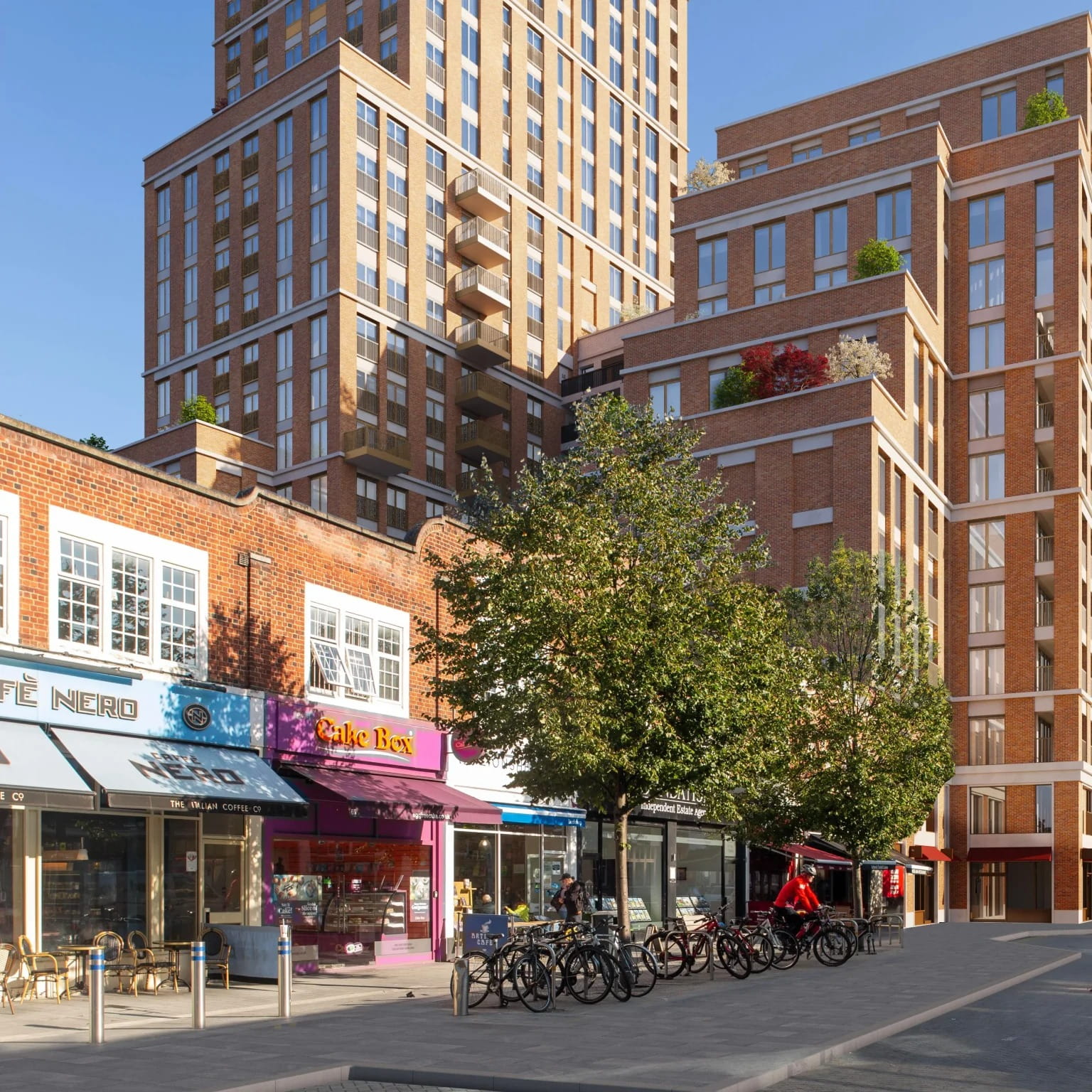
Planning projects often face challenges when visual impact is unclear or misunderstood.
Clear imagery removes ambiguity and supports decision-making.
Accurate visuals reduce the need for additional clarification.
Transparent visuals help communicate proposals more effectively.
Outputs align with recognised standards and guidance.
Verified views show realistic scale and context from agreed viewpoints.
They are used to support planning applications by showing how a development will appear from specific viewpoints.
They are highly accurate when produced correctly, using calibrated photography, survey data and aligned 3D modelling.
If you need verified views in Braunton, Devon, Bristol or the wider South West that meet planning expectations and provide reliable visual evidence, Ocean AVR offers the expertise and experience to support your project.
Every visual is built on precision, compliance and a clear understanding of planning requirements, helping you move forward with confidence.