
AVR Level 3 Visualisations for Proposed Electricity Pylons
- Project:
- Little Wenham, Suffolk
- Client:
- Fuller Long, Planning & Heritage Consultants
- Development:
- Proposed electricity pylons
- AVR Level:
- Level 3
- Planning Inspectorate Reference:
- EN020027
- Methodology:
- Landscape Institute TGN 06/19
- Services:
- Verified Views / Accurate Visual Representations, site photography, location survey, 3D modelling, drone photography and image composition
- Deliverables:
- Two ground-based AVRs, one supplementary aerial AVR and supporting methodology report
- Outcome:
- Accepted by The Planning Inspectorate for formal examination
Supporting a Planning Objection in Historic Little Wenham
We were commissioned by Fuller Long, Planning & Heritage Consultants to produce a series of Accurate Visual Representations (AVRs) relating to proposed electricity pylons near the historic hamlet of Little Wenham in Suffolk.
The visualisations were required to support a planning objection and help demonstrate how the proposed infrastructure could affect the character and setting of the area. The case being advanced was that the electricity cables should be placed underground rather than carried by the proposed pylons.
For a project of this nature, the visual material needed to do more than illustrate the proposal. It needed to provide an accurate and transparent representation of the pylons within the existing landscape, giving the planning team reliable visual evidence for formal examination.
We provided the complete visualisation service, from site photography and location surveying through to 3D modelling, final image composition and preparation of the supporting AVR methodology report.
Producing Planning-Compliant Level 3 AVRs
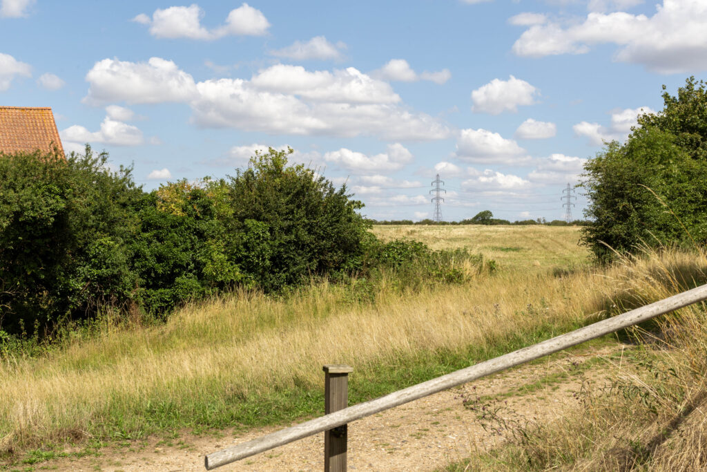
Three final AVR Level 3 images were produced: two conventional ground-based views and one supplementary aerial view captured using drone photography.
For the ground-level photography, we followed the relevant Landscape Institute Technical Guidance Note 06/19 (TGN 06/19) methodology. Location information was gathered on site using an RTK GIS collector, providing the accurate spatial data needed to reference the viewpoints and proposed infrastructure.
The site information was then used to position the 3D elements accurately within the photographed landscape.
This combination of controlled photography, location survey information and 3D modelling allowed the proposed pylons to be shown within their real-world context rather than as isolated architectural or engineering renders.
Overcoming a Challenging Castle Viewpoint
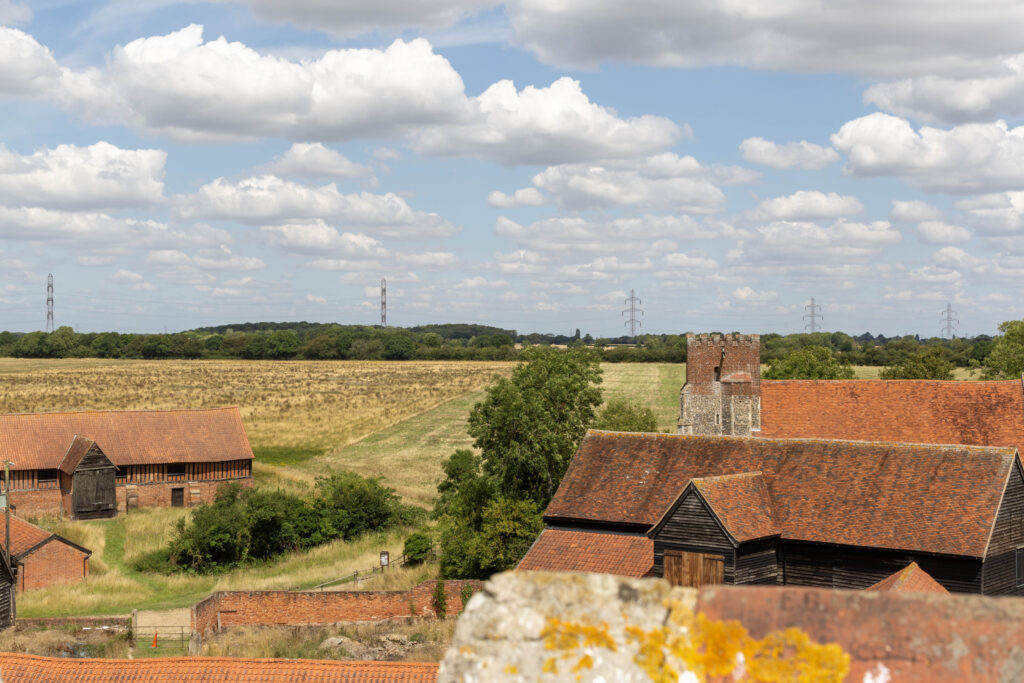
One of the project’s main practical challenges came from working in a highly confined space at the top of Little Wenham Castle.
Accurate planning visualisation depends heavily on reliable viewpoint and location information. Restricted working conditions therefore had to be accommodated without compromising the quality of the data required for the final visualisations.
We addressed this by gathering sufficient detailed location information while on site and combining it with broader geographic data.
In particular, wide-area point-cloud information from the DEFRA National Lidar Programme was used alongside the project-specific site data. This allowed us to reference the detailed local buildings and landscape accurately while also establishing the wider landscape context containing the proposed pylon route and individual pylon locations.
This was particularly important because the planning issue extended beyond the immediate foreground. The visualisations needed to communicate how the proposed infrastructure related to the wider setting around Little Wenham.
Ocean AVR's First Aerial AVR Using Drone Photography in Suffolk
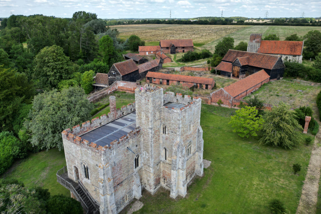
Little Wenham also represented an important technical milestone for Ocean AVR: it was our first use of aerial photography in the production of an AVR image.
The supplementary aerial viewpoint provided a different perspective from the two ground-level views and helped show the relationship between Little Wenham, its surrounding landscape and the proposed pylon route across a wider area.
The aerial AVR required a different positioning approach from the standard ground-based methodology.
Rather than relying solely on the ground survey process, the aerial view used the drone’s onboard GPS readings, combined with point data collected during the site survey. These datasets were then used to establish the information necessary for accurate image composition.
The result was an additional Level 3 visualisation that complemented the ground-based images while providing the planning and heritage consultants with a broader visual understanding of the proposal.
Combining Local Survey Data With Wider Landscape Information
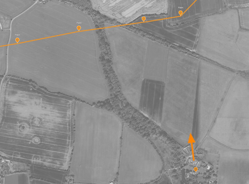
A key technical requirement was accurately referencing both the immediate historic setting and the much larger landscape through which the proposed infrastructure would pass.
Our methodology therefore combined several sources of spatial information rather than relying on a single dataset.
Detailed site measurements and RTK GIS information established accurate local reference points. Drone GPS information supported the aerial photography, while DEFRA National Lidar Programme point-cloud data provided additional information across the wider landscape.
Together, these sources allowed the 3D work to be referenced against both the buildings and landscape close to the viewpoints and the more distant route and proposed positions of the electricity pylons.
This illustrates why the survey and data-capture stages are fundamental to planning AVRs. The final image may be the most visible part of the work, but its reliability depends on the quality of the information collected and referenced before image composition begins.
Final AVR Deliverables
Following photography, surveying, modelling and composition, Fuller Long received a complete visual package comprising:
- Two ground-based Level 3 AVRs
- One supplementary aerial Level 3 AVR using drone photography
- An AVR report containing viewpoint/location information and the methodology used to produce the visualisations
No seasonal photography was required for this project.
The completed material gave Fuller Long a set of planning-focused visualisations with which to communicate the potential visual relationship between the proposed pylons and the historic Little Wenham setting.
Accepted for Formal Examination by The Planning Inspectorate
The AVR material formed part of the planning evidence associated with the proposal under Planning Inspectorate Reference EN020027.
The submitted material was accepted by The Planning Inspectorate for formal examination.
The role of Ocean AVR was to provide accurate visual evidence for use by the planning and heritage consultants rather than to determine the planning merits of the scheme itself.
For us, the project also demonstrated how established Verified View and AVR techniques can be adapted to more unusual viewpoints and project requirements while retaining a rigorous approach to spatial referencing and visual accuracy.
Specialist AVRs & Verified Views for Planning Projects in Suffolk & The Wider UK
Established in 2003, Ocean AVR provides Verified Views, Accurate Visual Representations and planning photomontages for planning consultants, architects, property developers, renewable energy developers and commercial development teams throughout the UK.
The Little Wenham project combined several aspects of our specialist service: technically controlled ground photography, RTK location surveying, 3D modelling, point-cloud information and, for the first time in our AVR production work, aerial drone photography.
Our planning visualisation work is supported by more than 20 years of industry experience, £5 million Professional Indemnity Insurance and experience working in accordance with Landscape Institute TGN 06/19 methodology. These wider Ocean AVR credentials are established in the campaign materials.
If a planning application, objection or visual assessment requires clear and technically robust visual evidence, we can discuss the required viewpoints, site conditions and appropriate AVR methodology at an early stage.
+44 (0)7808 934 462 | joe@oceanavr.com
Discuss Your Project With Ocean AVR